Depending on your project location, type and complexity, here are just some of the additional reports that may be required for your project. Architects will research and write many of these themselves, however there are also specific reports (such as those requiring contamination analysis of the plot or an assessment of wildlife in the area, that will require further input from specialist professionals.
 Ecological Appraisal
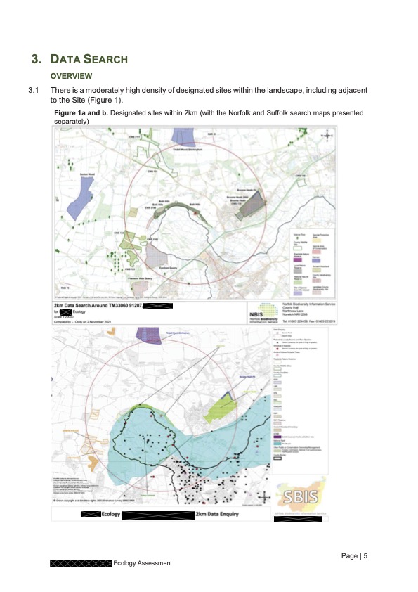
Where works are carried out that may impact directly on potential wildlife habitats or are in proximity to them (for example in or near chimneys, eaves, trees, water courses or affecting boundary features such as hedges and ditches), then an ecological appraisal is required.
These reports assess the relative importance of the feature in question to the local wildlife, the impact the works may have on them, and identify if any protected species are on the site. They must be completed by a qualified ecologist.
In the first instance (where the nature of the wildlife occupation is unknown), this will involve the ecologist carrying out a desk top study and visiting the site to make a preliminary assessment. They will carefully examine access to and from the site, review the local terrain and nearby protected habitats (such as nature reserves and sites of scientific interest) and investigate any signs of wildlife habitation, such as markings or droppings. In the case of Great Crested Newts, they may also carry out a DNA test of nearby ponds.
In some cases, this is all that is required. But in properties that are high value habitats, or where evidence is found of protected species occupation (such as bats or owls) further site visits and studies may be needed. These will typically be aimed at observing the animals themselves and will be specifically timed to suit the target animals’ habits. For example, where bats have been identified, at least one dawn and one dusk (perhaps more, dependant on the site) emergence study is required to observe bat activity. As bats hibernate, these studies can only be carried out between May and October and are highly weather dependent. A restriction that may well impact the timing of your planned building project.
It is worth noting that since the November 2021 Environment Act, every Planning Application is required to include measures that enhance biodiversity, by at least 10%. These could include the use of specialist housing (such as bat or bird boxes, bee bricks or insect ‘hotels’) or beneficial planting or a combination of both. All these measures will be proposed in the Ecological Report and should be carefully reviewed prior to submission.
Arboreal Assessment
Where works are carried out in proximity to, and particularly within falling distance of, trees and hedges, an arboreal assessment must be submitted to assess what impact the proposals might have on the local environment. Again, this needs to be carried out by a qualified assessor who can review the impact of works on tree roots and identify where trees can be safely cut back or would need to be removed to accommodate the works. This includes an assessment of the quality of the tree (taking into consideration species, age, key dimensions, health and landscape impact), and the proximity of the tree to the works.
A good arboreal report will include details of any tree or hedge protection required during construction of the project and details of any replacement planting that may be needed to compensate for the proposed removal of trees and hedges affected.
![]()
 Contamination Report
All Planning Applications need to identify if the site is likely to have been exposed to the risk of contamination by chemicals or other contaminants and to establish whether the new proposed use would infer vulnerability to contamination of the occupants or users. Typically this might affect any residential building, schools, medical facilities or similar although there may be other considerations.
Where a domestic property is being extended, a simple statement in the supporting documents (typically in the Design and Access Statement), is acceptable to acknowledge that the risk is negligible or non-existent. However, where a site has, or even may have been, used for the storage of any form of chemicals, including petrol or diesel, more detailed information will be required. For some Councils this means a questionnaire and an annotated site plan, whilst other Councils require a more detailed desk top study. In some instances, actual site analysis i
s required, although this is sometimes identified by the Council as a condition of the final decision, rather than a requirement to determine the application overall.
Unless you are fully aware of the contamination of your site, we would always recommend that a specialist engineer is appointed to carry out this assessment.
Flood Risk Assessment
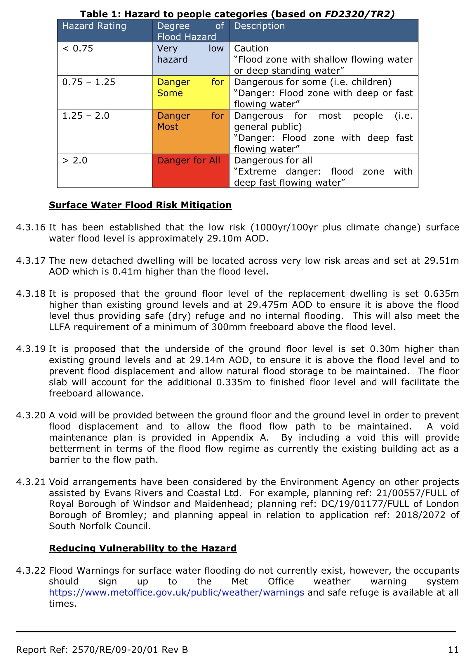
For sites under 1 hectare, a flood risk assessment report is only required if your site is located within flood zones two or three; if your proposal is considered a vulnerable use; or if it has been identified as being within an area of having critical drainage problems. The flood risk zones can be checked through the Environment Agency’s planning map: https://flood-map-for-planning.service.gov.uk/. Sites over 1 hectare require a full assessment regardless of the site’s relative location to the flood risk zones.
The flood risk assessment, as its name suggests, assesses the site’s likelihood of flooding. Usually four main types of flood risk are considered: fluvial (where a watercourse, typically a river, overflows it’s banks); coastal (where the sea breaches the shore); ground water (where the water level within the ground rises and seeps through the surface: a slow action flood event which can be prolonged); and surface water (including sewer flooding or when the ground is incapable of absorbing rainfall, typically during high intensity storm events).
This is a desk top study carried out by a specialist agency who can access and analyse data and mapping information to accurately assess the risks.
The flood risk assessment will highlight the mitigation methods that have been incorporated in the design – which is why a Flood Risk assessment is an important document to initiate early on in the design process (particularly when working on a site known to flood, or close to water courses). In some instances, a longer-term management strategy can be incorporated in the assessment.
When a high flood risk is identified and safely mitigated for, the Environment Agency is likely to also require an escape strategy or flood response plan which will need to be kept on the property.
These are just a sample of the most common reports requested by Planning authorities that we help our clients navigate. But there are many more, including Archaeological Assessments; Energy Statements; Landscape and Visual Impact Assessments; Daylight/ Sunlight assessments; Structural surveys and Refuse Storage Plans, to name just a few. Many of these are dependent on the type and size of project you are planning but it is important, whatever scale of project you have in mind, whatever the landscape surrounding it, and whatever type of building you are considering, that you prepare your application with careful consideration to these requirements at the outset.
 Ecological Appraisal
 Contamination Report